The Study on the Adjustment of the HCMC Master Plan up to 2025
Urban Planning Institute Ho Chi Minh City, Vietnam 2006

  • This project aims to update the 1998 Master Plan (Construction Plan) of Ho Chi Minh City. The project shall also develop a GIS database for use in planning activities of the Urban Planning Institute of Ho Chi Minh City.

SRDP provided the following GIS services:

  • GIS and mapping support to the multidisciplinary team
  • Geographic data processing, analysis and documentation
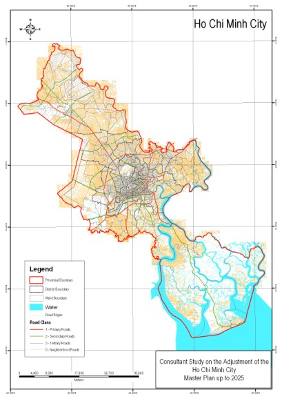
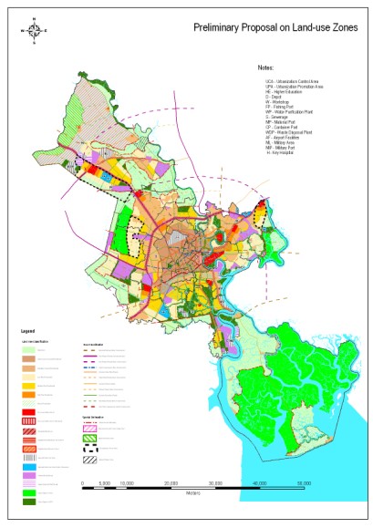
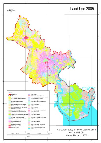
  • Preparation of thematic maps such as satellite image maps and land use maps
  • Management and technical support in the conversion of HCMC topographic and land use maps into GIS format
  • Technical transfer to UPI staff involve in mapping and GIS

Sample Outputs:

Basemap Masterplan Landuse Map

Return to GIS for Urban & Regional Planning projects list