|
|
|
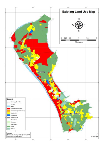
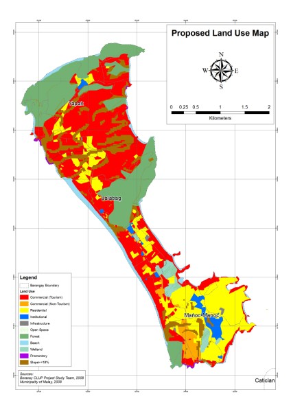
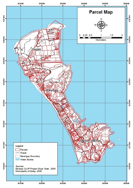
| Existing Land Use Map | Proposed Land Use Map | Parcel Map |
|
|
|
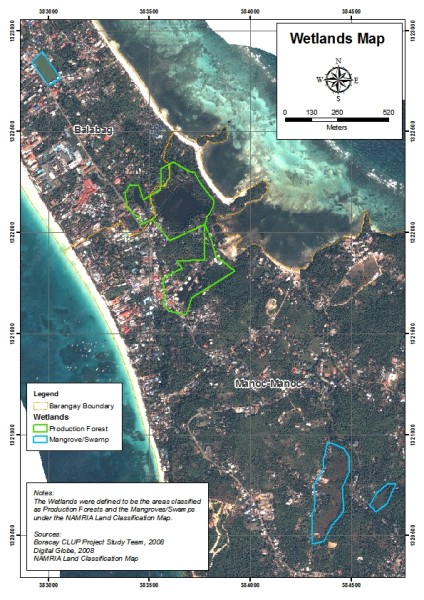
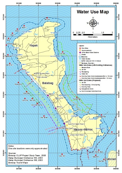
| Wetlands Map | Proposed Public Transport Routes Map | Proposed Water Use Map |