|
|
|
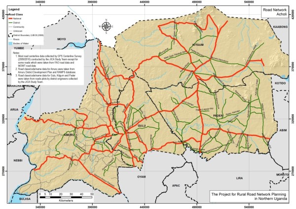
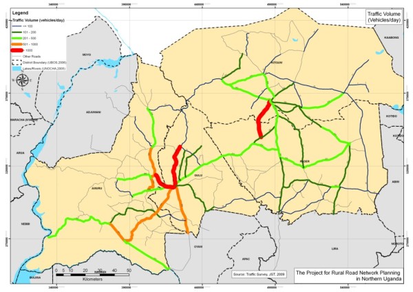
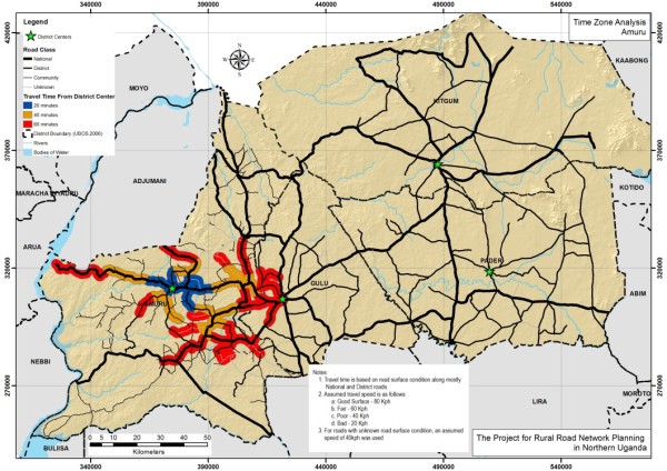
| Road Network | Traffic Volume | Time Zone Analysis |
|
|
|
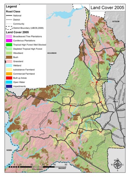
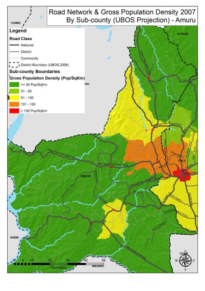
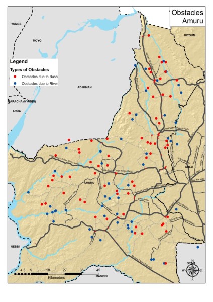
| Land Cover (2005) | Road Network & Gross Population Density (2007) by Sub-county | Bottlenecks |