|
|
|
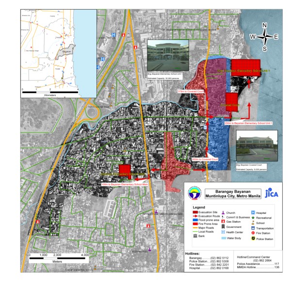
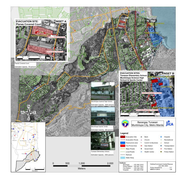
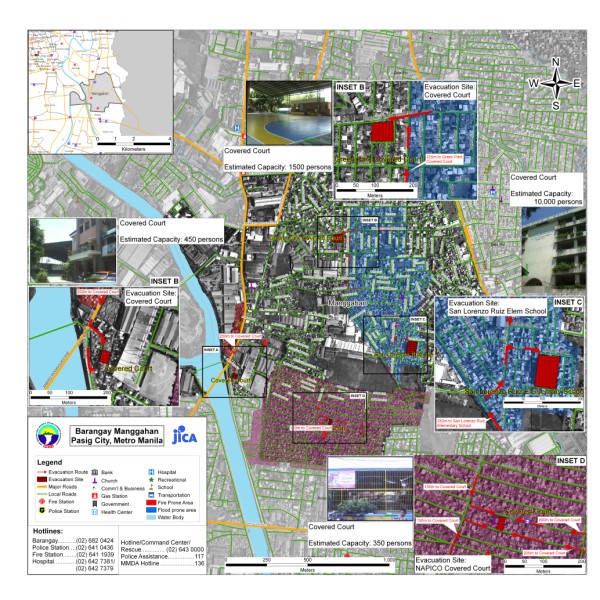
| Brgy. Bayanan Muntinlupa City | Brgy. Tunasan Muntinlupa City | Brgy. Manggahan Pasig City |
|
|
|
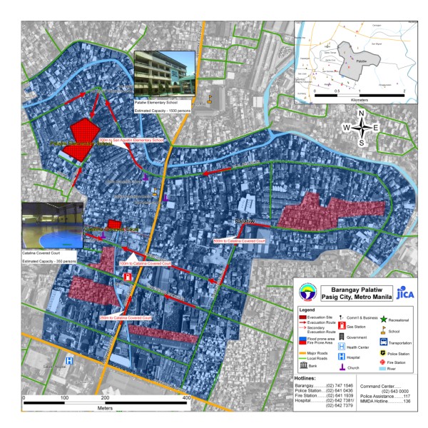
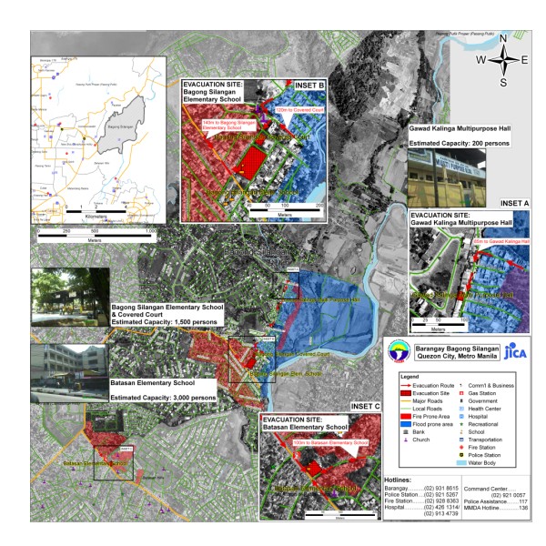
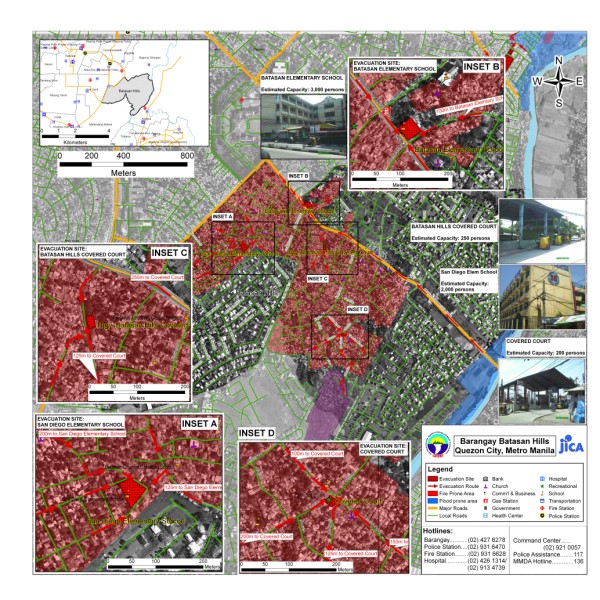
| Brgy. Palatiw Pasig City | Brgy. Bagong Silangan Quezon City | Brgy. Batasan Hills Quezon City |
|
|
|
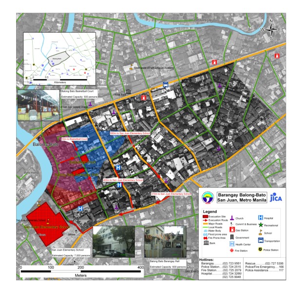
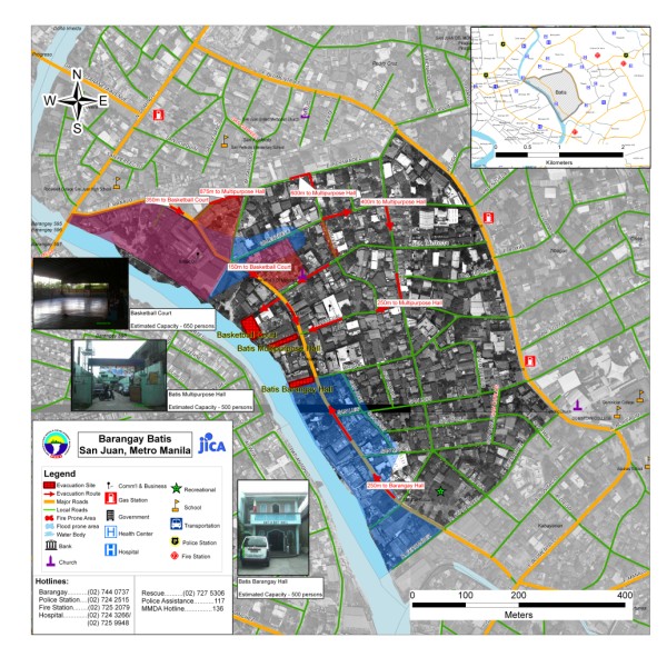
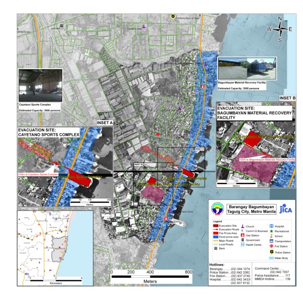
| Brgy. Balong Bato San Juan City | Brgy. Batis San Juan City | Brgy. Bagumbayan Taguig City |
|
||
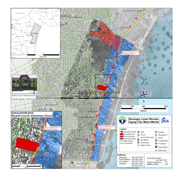
| Brgy. Lower Bicutan Taguig City |