The Study on Extracting Deep Collapse Hazardous Streams, Hazard Mapping and Installation of Rainfall Gauging Station in East Java

Japan International Cooperation Agency (JICA) Jember, East Java, Indonesia 2010
  • The objectives of the study are to prepared deep seated potential hazard maps and debris flow hazard maps for seleted areas in Jember, West Sumatra, and Sulawesi and to prepare a draft manual for researching banjir bandang (flash flood) hazardous areas and a manual for emergency evacuation for banjir bandang.


SRDP provided the following GIS services:

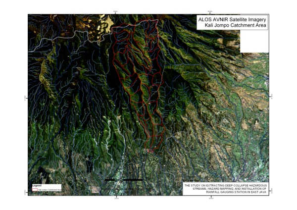
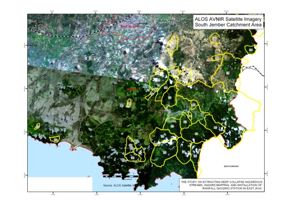
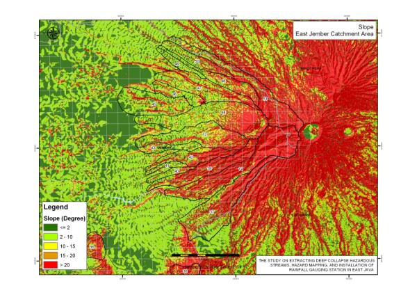
  • Development of a comprehensive database covering the target areas of the study, namely, Jember in East Java Province, Tanah Datar in West Sumatra, and Palu/Sinjai in Sulawesi. to support various analysis works for the study
  • Database and GIS support to the multidisciplinary team
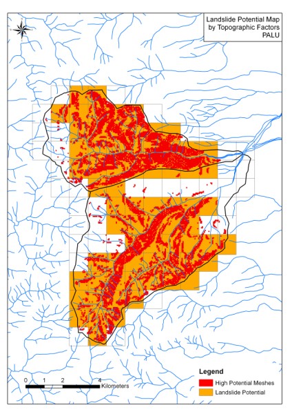
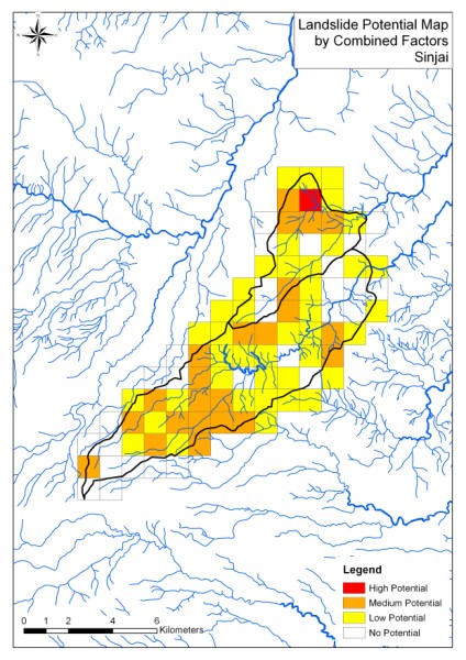
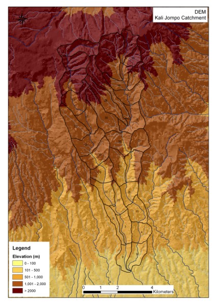
  • Analysis of deep collapse landslide potential and debris flow hazard in selected catchment areas in Jember, Padang and Sulawesi
  • Preparation of manuals for analyzing landslide potential, debris flow hazard and evacuation for flash floods

Sample Outputs:

Satellite Imagery: Kali Jompo (Kabupaten Jember) Catchment Area Satellite Imagery: South Jember Catchment Area Slope Map: East Jember Catchment Area
Landslide Potential Map by Means of Topographical Factor: Palu Landslide Potential Map by Means of Combined Factors: Sinjai (Sulawesi) DEM: Kali Jompo

Return to GIS for Disaster Management list