Master Plan for Flood Management in Metro Manila and Surrounding Areas

The World Bank Metro Manila and Surrounding Areas, Philippines 2012
  • Due to natural causes, such as typhoons, and to rapid developments in Metro Manila and its surrounding areas, flood vulnerability has continued to be a problem throughout the years. And while the risk increases, flood management measures (both structural and non-structural) remain inadequate. It has become necessary that a risk assessment study be conducted. With this, a comprehensive flood risk management plan to guarantee safety against risks and mitigate potential damages.

SRDP provided the following GIS services:

  • Research and collection of data
  • Development of GIS database for Metro Manila and the surrounding areas
  • GIS support to multi disciplinary team
  • Preparation of spreadsheets to estimate damages caused by floods
  • Preparation of maps
  • Preparation of GIS reports

Sample Outputs:

Typhoon Ondoy Flood Simulation Typhoon Ondoy Flood Simulation by Pasig-Marikina River (If There's No Manggahan Floodway and Napindan Gate is Closed) Probable Flood by Upper Marikina River (10-Year Return Period)
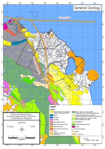
Expected Residential/Built-up Areas Geologic Map Typhoon Ondoy 2-Day Rainfall

Return to GIS for Disaster Management list