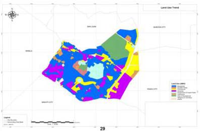
LAND USE PLANNING
- The use of accurate base maps greatly facilitates land use planning activities. SRDP is experienced in supporting local government units with their comprehensive land use plans by providing land use maps, which show residential, commercial, industrial & agricultural zone boundaries.
SRDP also supports resource management & planning activities especially with land use temporal change analysis.
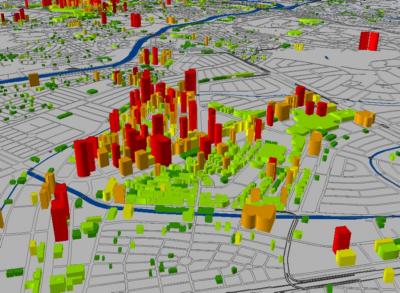
DIGITAL TERRAIN & 3D MODELING
- For maps to be visually presentable, Digital Terrain Modeling and 3D Modeling comes in.
Eye-catching and informative, 3D maps can show the relationship between different ground features or layers in a more realistic way.
3D maps can be use in Disaster Management, Environment Management and even flood control project.