SPATIAL DATA INTEGRATION
- This service includes:
* Assessment of Current Data. SRDP visits the different departments in the client organization to investigate and collect available and relevant data holdings.
* Integration / Cataloging of Data. SRDP performs standardization procedures on the various GIS data collected, converting them to a common coordinate system and uniform format.
* Documentation. SRDP documents all the GIS data holdings of the client organization.
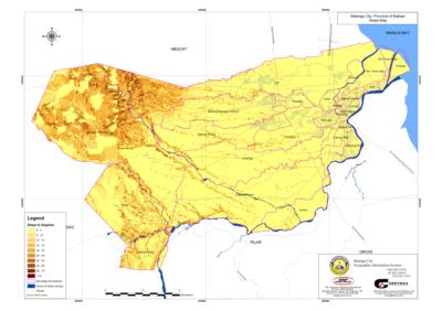
* Production of Thematic Maps. SRDP produces thematic maps based on the available GIS data, showing specific themes like elevation, building use, population density, or hazard information.
DATABASE DESIGN & BUILDING SERVICES
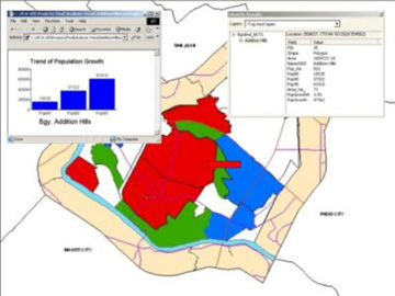
- SRDP recognizes the need for an accurate database in the successful implementation of a geographic information system. SRDP provides database design and buildup services according to client requirements and specifications.
SRDP can support GIS users and clients build up their databases.
NETWORK INFORMATION SYSTEM
- In partnership with Keypro, SRDP is involved in Network Information Systems - solutions that help to efficiently manage water, sewer and telecom networks.